
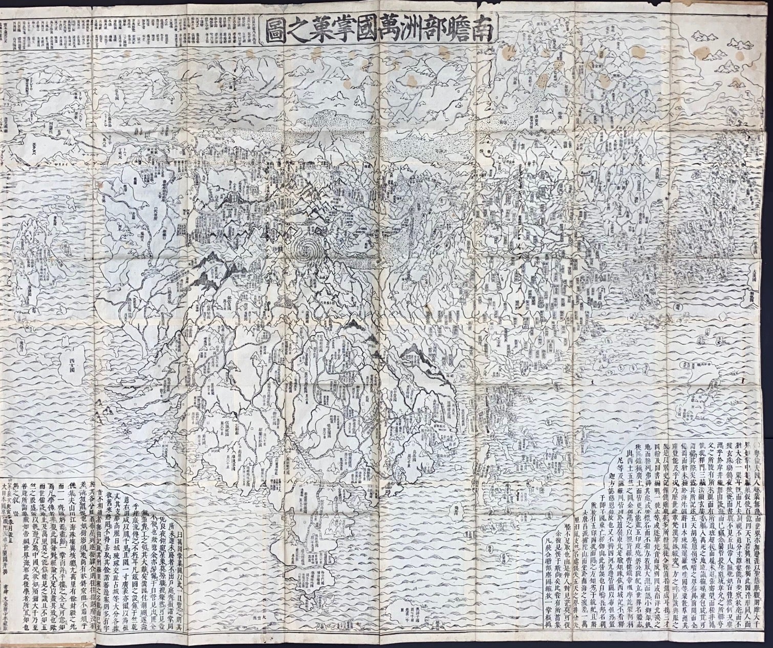
Nansenbushū bankoku shōka no zu 南瞻部洲萬國掌菓之圖
Kyoto: Bundaiken Uhei 文臺軒宇平, 1710. map. Approximately 55.5x46 inch folded map, fitted together from separate woodblock prints. One of the thick paper covers (which protect the map when folded) is partly separated but still holding on. A few minor wormholes and edge chips have long ago been reinforced with backing paper. Some yellow spots are spread across the upper portion. Dated by the preface, though as with most woodblock prints, the blocks would have been saved and additional printings could have been made from them after this date.
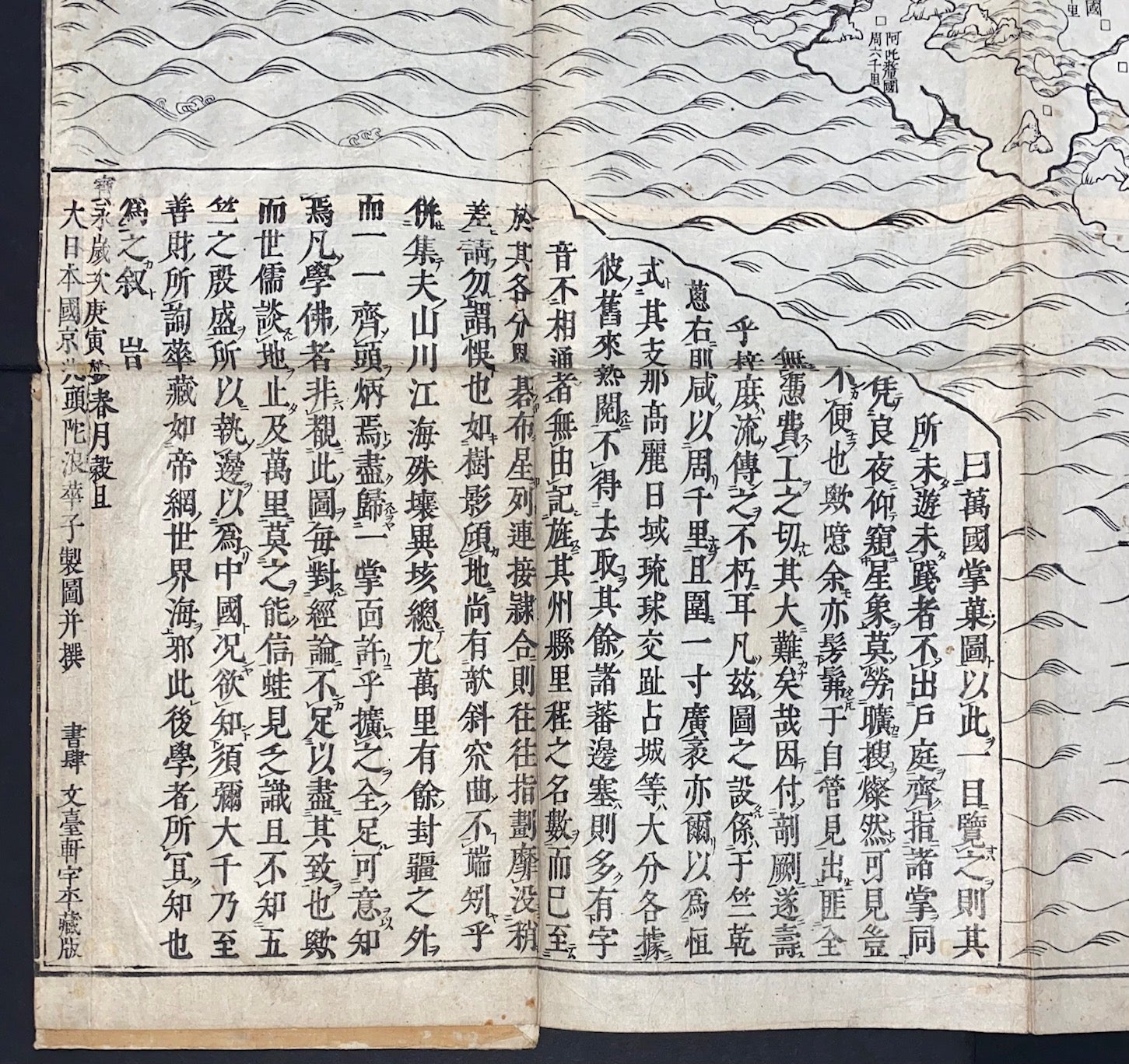
This "Map of the Countries in Jambudvipa" was a landmark of Japanese efforts to adapt the geographical traditions of Buddhism to newer information about far-flung countries gleaned from the maps of merchants and missionaries. Although the monk Hōtan rejected the "Five Continent theory" widely promulgated in China and the region by the maps of Mateo Ricci and his successors, it had nevertheless become impossible by this point to completely deny the existence of Europe and the Americas. Europe has been added to the northwestern region of Jambudvipa, while the Americas are depicted as small islands to the east. The map lists its numerous textual sources in a long box at the top, with an essay by Hōtan at the bottom criticizing non-Buddhist geographical works. Hōtan lists errors of placement for various foreign states in such books as the Sancai tuhui, the Tushu bian and the Da Ming yitong zhi, all of which he blames on the failure of their authors to consult Buddhist sources. See Alexander Akin, "East Asian Cartographic Print Culture," pp. 249-251, and Toshikazu Kaida, “Nansenbushu Bankoku, the first Japanese printed map of the Buddhist world”, IMCS Journal, Summer 2016, No. 145, pp. 35-44.
Cat.No: 297976
Price: $6,000.00